
Installation User manual Tracks Routes POI FAQ Customization Projections and datums Forums Known bugs Map Conversion How-To Libraries Changelog Links Help this project Contact Credits
Points of interest
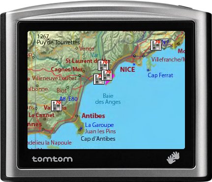
ttMaps can display points of interest on the map. If there is no icon matching their category, they are marked by concentric blue and orange discs:
Icons
Each category of POI may have its own icon. This icon should be installed in the ttMaps/POI folde, as a PNG file whose name is formed by the category name followed by the extension .png. For example, if you created a category "Post offices", create a file "Post offices.png". The standard format is 22x22 pixels, but it is not mandatory. ttMaps manages the transparency of icons.
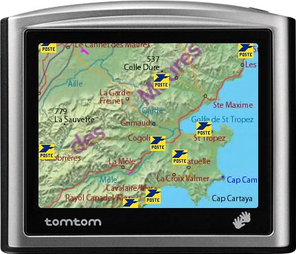
Example of icon (French post offices):

Look at the result :
Import POIs
ttMaps is able to import POI files in OV2 format (TomTom) and GPX format. When a POI file is imported, a new POI category is created, it is named from the name of the file (without the .ov2 or .gpx extension). If the category exists already, POIs are added to the existing category.
GPX files to be imported must be placed in the ttMaps/POI folder. But the OV2 files must be placed in the folder of the current map of the TomTom, such as "Western and Central Europe." This allows sharing points of interest between ttMaps and TomTom navigation software. If no TomTom map is installed, put the OV2 file in the ttMaps/POI folder.
Export POIs
ttMaps can export POI categories to files in OV2 (TomTom) or GPX formats. The files get the name of the category, followed by the extension .ov2 or .gpx.
GPX files are exported into the ttMaps/POI folder. But the exported OV2 files are placed in the folder of the current map of the TomTom, which makes it possible to use them in the TomTom navigation software. If no TomTom map is installed, OV2 files are placed in the ttMaps/POI folder .
Last modification : 25/06/2009